Life comes at you fast: On Monday, I was not at all interested in birdwatching. On Tuesday, I was obsessed with it for two straight hours. I am probably not the first person to tell you that you should, as soon as you can spare one hour and 59 minutes, watch the film Listers: A Glimpse Into Extreme Birdwatching.
Someone sent me a link to it on August 29th, 10 days after it went live on YouTube (thanks, Jason), followed by four or five other people. By the time I got around to watching the first 20 minutes of it, I was so taken with it that I thought “surely someone’s written about this.” And yes, Slate had written an article about it, as had the folks at GearJunkie. In the first month after it was released, it had 1.1 million views on YouTube. So what makes it so good?
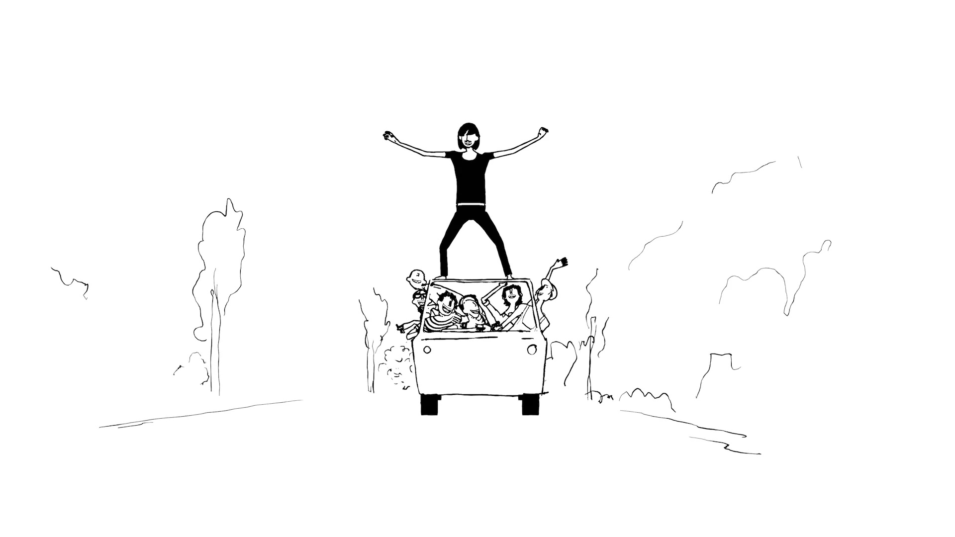
The story: Two brothers from St. Louis—who are very novice birdwatchers—take one 2010 Kia Sedona minivan and one year to attempt a “Big Year,” the birding term for a person trying to identify as many birds as possible, by sight or sound, in a geographic area in the span of one calendar year.
Two minutes into the film, Quentin Reiser, sitting in front of the camera, explains the genesis of the adventure: “One day I got high and found the family’s bird guide book. And I thought about how crazy it would be if you knew all the birds in that book. Just how insane that is.”
As he’s saying those three sentences, his younger brother, cinematographer Owen Reiser, pans the camera down a bong to show it sitting on top of a copy of Birds of North America: A Guide to Field Identification.
Quentin and Owen come off as two regular guys with almost zero knowledge of birding (which they are) but they also obviously worked really, really hard on this film—which is, by the way, free to watch on YouTube (because Owen has not turned on ads for it). Owen is a legit professional cinematographer who has shot documentary footage for National Geographic and others, and brings that production quality to the video footage of birds in the film. But he also had a vision for the aesthetic of the film (I believe), and almost everything else in the film is vérité, with hand-built animations and graphics—which makes the film feel more authentic to the experience of eating-rice-and-beans while living out of a 2010 Kia Sedona with your brother, camping in Cracker Barrel parking lots.
Quentin is very comfortable in front of his younger brother’s camera and dropping profane wisdom during the sit-down interviews (“Dude, holy fuck mosquitoes love to be inside your van”), or living the adventure in real time in the field, like when he’s enthusiastically snapping photos of a Montezuma Quail in Arizona in March, and he quietly announces, “I’d run through a brick wall for that bird.”
The brothers find their way into the birdwatching community (and interview many of its more accomplished birders), explain everything they learned about birdwatching to the rest of us non-experts, do it in their own style, don’t gloss over the uncomfortable parts (the mosquitoes, the heat, the negative side of competing to identify more birds than anyone else, the discomfort of living in a very small old minivan), but capture the joy of discovery and adventure, and will make you laugh out loud (I promise).
Maybe what works best about the whole thing is that it’s fun. These two are clearly fun to be around, enjoy being fun, and even though they’re dedicated to this obsessive quest that definitely changed their lives, it almost always feels light. If you take a second to examine the graphics and animations, you can imagine Owen having fun creating them, dedicating an hour (or hours) to something that he knows will be on the screen for only a handful of seconds. These two are real artists who have made a Very Fun Thing, and many of us probably need that kind of fun right now.
The film is free, but you can support it or say thanks through Owen’s Venmo or by buying the book Quentin and Owen made about the trip on Bookshop or Amazon or Barnes & Noble.
I don’t often re-publish stories I’ve written, but I remembered this one this past week when I was tagging along on a rock climbing trip in the desert with my mom and her friends. I think this essay, back when I wrote it in 2013, was a sort of expression of gratitude through a story about my grandma (my mom’s mom), who was in the last 14 months of her life at the time I published it. I hope it still resonates.
—
I flew to Iowa to visit my grandmother in the hospital a couple weeks ago. She’s been in and out of hospitals for the past few months, kind of one thing after another, the latest being a dental infection. I got off the plane in Des Moines, rented a car and drove straight to the hospital, where she was in bed, the right side of her face swollen up around the infection, IV drip in her arm.
I sat with her for three days, leaving when she went to sleep at night and took naps in the afternoon, but mostly we just sat and chatted like we always do. I ran across the street a couple times to get her milkshakes and real coffee from the coffee shop a block away. She only drank a few sips of it, but it didn’t matter. If it was between hospital coffee and espresso, I thought she should have espresso.
We went for short walks up and down the hallway, Grandma apologizing for how slow she was going, shuffling with her walker in front of her, and me telling her that she was the fastest 85-year-old lady I’d hung out with, plus I didn’t have anything else to do that day anyway. I have about a dozen deadlines and a million e-mails, but only one grandparent. Sitting there in the chair next to the hospital bed, helping her in and out of the chair, cutting up her food, I wondered how many more times I’d get to spend the whole day with my grandma, just me and her.
My grandma knows I live in a van and that I’m a writer, and I don’t think she cares what I do as long as I’m happy. She doesn’t read my blog, or care too much about rock climbing and mountains, and she knows I travel a lot, but I don’t think she cares where — I think she sees me in one of two locations: in person, and at the other end of the phone line wherever I call her from.
While I was visiting her in the hospital, I was supposed to talk her into moving into an assisted living home five minutes from my parents’ house, where she’d have her own apartment and her seven kids would be able to visit more frequently. I tried a little bit. Her other option was a nursing home in her hometown, and she liked that idea better, despite the wishes of all of her kids. She’s lived in the same town, Emmetsburg, Iowa, pop. 4,000, her entire life, and in the same house since 1956. She’s not going to be able to go back to her house, but she doesn’t want to leave Emmetsburg, where she raised seven children, and outlived almost every single one of her friends.
When we talked about the assisted living home, she said across the hospital table, “Brendan, I don’t want to go somewhere I don’t know anyone.”
I said Grandma, I go everywhere, and I don’t know anybody.
Which is a stupid thing to say to your grandmother when you’re a young guy who loves to travel, and she’s talking about leaving the same house she raised a family in for 30-plus years, and then lived in alone for 26 years. She said, I mean, Can you imagine me leaving the only place I’ve ever lived? and I understood how scared she is.
I’ve had something like 23 different addresses in my life, and every time I moved out of another apartment, I had a little twinge of nostalgia, a little sadness as I closed the door on all the emptied-out rooms I’d made memories in. My grandma had to multiply that feeling times 66 years. Driving away from the hospital, I realized Grandma and I were both talking about freedom, even though it looks wildly different to each of us. She doesn’t want to live anyplace where people tell her what to do, and I suppose I’m kind of doing the same right now.
I guess we like to point out the traits we get from the people who raised us, how we’re like our people — I was raised on spicy food; my family’s always been Cardinals fans; we never back down, et cetera. I’ve spent most of my life rebelling against everything I grew up with, but I get it. When you’re 85, like my grandma, people say you’re stubborn. I think I’m just like her, but I call it driven. I fancy myself to be pretty tough, able to get myself out of any jam in the mountains with sheer perseverance. My grandma doesn’t care if anybody thinks she’s tough, but she fell and broke her hip five years ago, and walked around her house for three days thinking it was just bruised before she went to get an x-ray. My family, both sides, has never been shy about busting people’s balls, no matter the situation. It’s a true art, and I have a hard time relating to people who don’t know how to do it. My Uncle Dan, on Grandma’s second day in the hospital, told her, “Mom, we’re so optimistic, we’re gonna buy you some green bananas.”
We walked down the hallway one evening, just me and Grandma, past a few open doors of hospital rooms, and she apologized again for being slow, and I just walked next to her with my hands in my pockets and assured her I wasn’t in a hurry to go anywhere. She said Brendan, I bet you can walk anywhere you want, and I said Yeah Grandma, I guess I can. I thought about all the places I had walked, like the top of the Grand Teton and the bottom of the Grand Canyon, and I don’t know why my grandma had to say something like that hunched over her walker and shuffling along in a hospital gown and why it made me so sad.
Last Christmas, after I hugged her goodbye, she grabbed my hand with both hands, taking one more second. That was the first time she’d ever done that, and I walked out the door of my parents’ house wondering if she did because she wasn’t sure if it was the last time she’d see me. It wasn’t, of course, but I guess you never know when you get to be 85.
Someday she’ll be gone, and then I’ll be a wreck for a while, but I suppose after that, I’ll find a few good places to think of her when I’m out there being stubborn and walking anywhere I want.
We were scarcely eight miles into the 105-mile Tour du Mont Blanc when I narrowly avoided disaster. I had trained all summer for the steep ultramarathon days we planned to put in on the TMB. I came to Chamonix with 20-plus years of experience in the mountains, which I’d like to think amounted to at least something like wisdom. I have calibrated and recalibrated my risk tolerance as I’ve gotten older, but you can’t think of everything.
In the mid-afternoon light of the small dining room of La Chalette, a mountain restaurant at the top of the Bellevue Cable Car, halfway through our first day on the TMB, I pushed down way too hard on the ketchup dispenser. A laserlike stream of tomato condiment completely missed the ramekin I held in my left hand, and the deep red bolt of ketchup sailed directly at a German hiker’s backpack sitting on top of the table. My heart leapt into my throat as I watched it unfold in slow motion.
It missed. A wave of relief washed over me as I apologized to the two hikers at the table and mopped up the ketchup with a stack of napkins. I returned to our table, freshly reminded that when you’re adventuring in the Alps, you expose yourself to many risks, and a faux pas while dispensing condiments is just one of them. We had almost 100 miles left to travel on foot, which I reminded myself is a big number, and an even bigger number if you measure it in kilometers, the standard unit used by every country in the world except the U.S., Liberia, and Myanmar—including France, the country we were in today, Italy, the country we’d be in tomorrow and the next day, and Switzerland, the country we’d enter on Day 4.
If you were to use a hotel breakfast croissant for a map of Mont Blanc (the croissant being Mont Blanc), this is what the TMB would roughly look like:
I was invited to run the Tour du Mont Blanc by my friend Doug Mayer, who founded a company called Run The Alps back in 2012 during the twilight of his career as a producer for, I shit you not, Car Talk. Doug grew up in New York and New Hampshire, fell in love with trail running in the Alps, and decided to reinvent himself as a guy who helps people do running tours in the Alps. He asked if I’d like to try one of their self-guided trips this year, and I said:
a) of course I would, Doug, but
b) I have a three-year-old and a lovely wife, so
c) what do you have that’s not a super-long commitment? What about
Doug said, Well, our regular Tour du Mont Blanc is actually way more popular for many reasons including the daily mileage, but sure, excellent choice, sir.
I asked Majell Backhausen, a North Face Australia athlete, freelance media pro, and environmental advocate if he would like to run it with me—which was a bit of a gamble on his part, since we had had several conversations but really hardly knew each other, and I was asking him if he’d like to spend 24 hours a day with me for five straight days, and he didn’t know if I snored at a high decibel level, or if I had a thing for conspiracy theories, or if I would demand he close down the hotel bar with me every night of the tour. He said yes.
DAY 1: CHAMONIX TO LES CONTAMINES
Day 1 was our short day, at 15.7 miles/25.3 km, from the Église Saint-Michel in Chamonix to Les Contamines. If you’ve ever seen footage of the start and/or finish of the UTMB, you’ve probably seen the Église Saint-Michel, aka “the church behind the start/finish arch.” A cliché place to begin (and hopefully end) our loop around Mont Blanc? We started in a light rain on Tuesday, September 5, to the sounds of work crews disassembling said arch, about 36 hours after the last UTMB runners had crossed the finish line.
We stopped after 1.2 miles/1.9 km for a croissant and a cappuccino, maybe to set the tone for the trip? I mean, we’re not trying to do this thing on a low-carb diet.
Many Tour du Mont Blanc trips actually start in Les Houches, about 4.5 miles/7.3 km down the road from Chamonix, or a quick 30-minute train ride. That option shaves a few less-epic miles off the first day—mostly roads and multi-use paths that we ran, and I get why people skip that part. By starting and ending at the church in Chamonix, we would have a nice clean-looking loop on the map of our route, which would exist mostly in our minds but also a set of GPX files, I guess.
After Les Houches, we began climbing in earnest up singletrack in a forest, while getting drenched by real rain, the kind of rain you hope you don’t get every single day of your trip. After our climb—about 2,500 feet/750 meters, we took a break at La Chalette to eat frites, aka French fries, aka chips, before finishing the second half of Day 1.
We climbed up through patchy clouds, passing a few dozen hikers, up to Col de Tricot, the high point of our first day at 6955 ft/2120 m, and then ran as the clouds gave way to full sun and we descended into Les Contamines. We popped into a grocery and grabbed a few post-run snacks, and Majell bought a baguette, ripped it in two, and handed me half. I wouldn’t say I was exactly hankering for a big hunk of dry bread at that exact moment, but when in France. Also, our next day was our biggest day of mileage and vertical gain, so I guess we’d be needing the carbs/glycogen.
DAY 2: LES CONTAMINES TO COURMAYEUR
Going into our TMB trip, I knew I would have to eat hotel breakfasts like it was my job. Fortunately, this is a job I love, especially in the hotels around Mont Blanc, where every morning is a buffet of pastries, breads, jams and nut butters/pastes, good coffee, eggs, and other delights.
Since Run the Alps had put together our self-guided trip, we hardly had to worry about details, and every morning we got up, packed our bags, ate as much breakfast as possible, loaded up our vests, and took off on our run. Not “took off” like we were bounding out the door running 7:30 miles—more like we walked out the door of the hotel, broke into a light jog while still digesting our breakfast, and ran to the start of the first climb of the day, which usually began fairly immediately.
Usually, in the first few miles of our day, we’d pass a few hundred hikers, all making their way on the same route we were, in the same direction. Each year, Mont Blanc draws 20,000 climbers hoping to summit, and each year, the same number of people—20,000—do the Tour du Mont Blanc, walking or running around the mountain. You can generally discern the itinerary of a TMB traveler by the size of their backpack:
Maybe an hour and a half into our second day, I heard someone behind us say “no way,” the voice of Adam Peterman, a guy from my neighborhood in Missoula who won the Western States Endurance Run in 2022. He was out for a training run with Caleb Olson, who won Western States in 2025, and we chatted with them for a few minutes before they detected that our priorities for the day were different than theirs, bid us goodbye, and took off running uphill.
A little past the eight-mile (12.9 km) mark, we had chugged up 4,200-plus feet (1280 m) to Col de la Croix du Bonhomme, our first big climb of the day. We jogged downhill a few hundred feet to the Refuge de la Croix du Bonhomme and popped in for a slice of cake and a lemon tart.
We ran singletrack down the 3,000-foot descent to the hamlet of Les Chapieux, where we took a proper lunch break and Majell made a sandwich out of a baguette and a small pizza:
Our next big climb was seven-ish miles (11.25 km) up to Col de la Seigne, on the border of France and Italy. This of course put us in a new country—Italy—but it also was the point in my mind where the view of Mont Blanc really started to dominate our field of vision. Like every time you took a photo, a solid chunk of your visual reason when you pulled your phone out of your pocket was, oh yeah, that’s a dramatic piece of Mont Blanc you’re looking at. A hiker from Singapore asked Majell to take his photo, and while pointing in the direction of Mont Blanc, asked if it was Mont Blanc, and I don’t know if it was the language barrier, but the correct answer was either, “The actual summit is in that direction but partially obscured” or, while gesturing broadly with one hand, “Yeah, that whole thing over there is Mont Blanc.” A big deal. Massive, or even a massif, if you will.
We ran the downhill, dropping about 1,800 feet (550 m) in three miles (5 km) to a brief flat section passing Lac du Combal, and then began our last climb of the day while Mont Blanc bathed in the best light we’d see all day (maybe the best light of the entire trip?). I mean, look at this shit:
(photo by Majell Backhausen)
The TMB traverses up through bits of forest to Arete du Monte Favre, then rounds a corner into the top of the Courmayeur Mont Blanc ski resort. We stopped to fill bottles at the Maison Vielle Refuge at Col Checrouit, then dropped via steep tight switchbacks into the town of Courmayeur, where we ended our 50km day at the Hotel Bouton D’Or. As soon as we showered, we walked to dinner at La Padella, where we split:
1 salade montagnarde
2 orders of gnocchi with cheese
1 order Pommes frites/French fries/chips
1 aI funghi pizza
2 orders of bread
I had a cold, which I’d felt the inklings of the day before our trip, thinking to myself, “Perfect timing, as always.” Thankfully, the next day was our “rest day,” which had been built into our itinerary by the folks at Run the Alps. At first I kind of pooh-poohed the idea of taking a rest day, but now I was more than happy to take one.
DAY 3: COURMAYEUR TO COURMAYEUR
We smashed a big breakfast even though we were not running on Day 3. Thanks to the hotel, I discovered the invention of pistachio paste. We bought tickets to the Skyway Monte Bianco, a tram system that took us to Punta Hellbronner, (3466 m/11,371 ft), via a rotating cable car. Then we ate more food and watched it downpour outside, which fortuitously passed through during the night.
DAY 4: COURMAYEUR TO CHAMPEX-LAC
The morning of Day 4, for whatever reason, the breakfast room at the hotel seemed way more crowded. Several groups looked like they were also headed out on the TMB. I gathered that one person in a big group near our table informed her friends that she was going to have to skip the next couple days and meet them in Champex-Lac, which must have been a huge bummer.
People reserve rooms in the hotels and mountain huts along the TMB about a year in advance, and the route is, of course, a circle with only a handful of towns along the way, so if you have to miss a day because you’re injured or sick or whatever, you might have to miss two or three days and shuttle around the mountain via taxi or bus before you can re-join your group at the next town.
Majell and I sat with our food and coffee, enjoying an immoderate breakfast and looking forward to another immoderate day on the trail measuring somewhere around 29 miles/48 km and 8000ish feet (2400 m) of climbing, according to the profile on our Run the Alps app:
The route started climbing literally a few feet from the front door of our hotel, up the winding streets of Courmayeur, picking up a trail at the edge of town after about a mile of pavement. We passed groups of hikers, Majell jokingly saying to me “surge!” before we sprint-hiked past the groups of 10 and 12 trekkers and my heart rate jumped into Zone 4 territory.
We passed by Rifugio Bertone after climbing 2,500 feet (760 m) in just over 2.5 miles (4 km), then ran as the trail mercifully flattened and contoured around the mountain. We cruised into Rifugio Bonatti, which Majell had said was more hotel than rustic mountain hut, and I ordered a couple cappuccinos and cookies. Majell had also, for some reason, purchased a one-inch-thick chocolate bar and would not let me not help him eat it, so, faced with another challenge in the mountains, I sat there in the sun and enjoyed all of it. There are many differences between the mountains in my beloved American West and the Alps, and every time I get to visit the Alps, I take advantage of places like the Bonatti refuge, which combines a couple of my favorite things: a mountain view and a solid espresso cafe. And also baked goods.
Only one-fourth of the way through our day’s map, we chugged on, dropping down a few hundred feet and then starting our next climb, 2,500ish feet up to Grand Col Ferret, the high point of the TMB at 8,323 feet/2,537 meters. We shared the trail and the col with dozens of hikers, and I stopped to take photos for folks posing in front of the view back down the valley, which, to be fair, is absolutely incredible on a clear day and if you’re alive and there in person you damn well better stop and look at it, because otherwise why did you even bother coming?
At the col, we said goodbye to Italy and hello to Switzerland, a country we’d be in for, *checks notes* almost 24 hours, eight hours of which we’d hopefully be asleep. We descended, running down, down, down, for 13 straight miles (21 km), stopping briefly for a coffee at Buvette de la Peule, and to stroll through the town of La Fouly. As we were jogging through the hamlet of Praz de Fort, Majell remarked that he’d been through this spot several times before and didn’t remember it being so scenic. I assume all those other times, it was either dark or he was blindfolded.
The last 3.5 miles/5.6 km, climbing one last gentle kick-in-the-shins 1400-foot (425 m) climb to Champex-Lac, took us a little over an hour, and by the time the Hotel Splendide came into view, I was ready for a chair. Fortunately, we had a room with an incredible view of the Grand Combin, and it had two chairs. There were more chairs in the dining room, where we ordered two dinners apiece and watched the moon rise over the Grand Combin, and I took the world’s worst moonrise photo with my iphone:
DAY 5: CHAMPEX- LAC TO CHAMONIX
This past spring, my friend Nick Triolo came out with a book called The Way Around: A Field Guide to Going Nowhere, and in it, he explores the idea of circumambulation, which is, according to the dictionary definition, “to circle on foot especially ritualistically.” It’s full of all sorts of beautiful prose and thought-provoking shit, ruminating on why (some) humans want to summit/conquer things and (some) humans find meaning in circumambulating things. Like this, from the introduction:
Having historically been a bit of a mountain summiter/“peak bagger” myself, but also loving a good loop now and then, I am a fan of both approaches. But I’ll say this: If your goal is to summit, there comes a point when it gets easier, usually halfway through the trip (or earlier). Of course I’m aware that the majority of mountaineering accidents happen on the way down the mountain, but aside from that unfortunate bit of data, once you summit, gravity is helping you get down. Maybe your pack is lighter, maybe you get a night or two of relaxing at base camp, maybe you walk off the top of El Capitan and hike back down to the valley.
On the other hand: If you’re doing a loop, such as, say, the Tour du Mont Blanc, you can’t really take your foot off the gas, so to speak, till you finish the loop, which ends where you started the whole thing—in our case, Chamonix. Yes, we could have taken a train back into town if we wanted to skip the final seven-ish miles/11 km if we were really in a bad way, but that would have to be an emergency, in my opinion (and before 8:21 p.m., when the last train leaves Le Tour).
We weren’t exactly bounding out the door of the Hotel Splendide after breakfast on Day 5—we walked most of the way through town, the past few days’ mileage weighing down our legs a bit. But we finally got going, jogging downhill until about Mile 3, and I reminded myself: Three more big climbs.
I also reminded myself: Many, many people do this whole loop in a single push. It’s called the Ultra-Trail du Mont Blanc, aka UTMB, and 1,665 people finished it this year, out of 2492 entrants. Three people in our shuttle van from the Geneva airport to Chamonix did it, out of seven. Anyway, plenty of those people must have been at least a little bit like “fuck this” by the time they got to Champex-Lac. But they kept going. Maybe even without stopping for espressos! The humanity.
About five miles/8 km in, on the first climb, a kid in his late 20s stepped aside to let me pass on the steep trail. I said Bonjour, he said Bonjour back, and then, “You are strong.” I laughed and nodded, looked at his big pack, pointed at my tiny 12-liter running vest and said “small pack. ” At the top of our climb, we stopped for water at the Bovine alpage, which must be one of the best places in the world to be a cow, I guess if you’re a cow who enjoys expansive views of stuff like the Rhône Valley almost a vertical mile below.
We dropped down into the town of Trient, stopping only for water, and settled into our 900-meter climb. Majell actually got out of my sight for what I think was the first time the entire trip, and I was not in a hurry to catch him. I kept plugging away in the intermittent shade on the trail, drenched in sweat and wishing for even the slightest breeze. Right around 14 miles/22.5 km, pretty much halfway through our day, we crossed the border back into France, which is not marked but paralleled the Tête de Balme chairlift right above our heads.
Just around the next corner, the dramatic north-facing expanse of Mont Blanc came back into view:
We would barely lose sight of it the rest of the trip, as we wound another 13 miles/21 km up and down into the Chamonix valley, stopping once at Chalets de Balme for a sunny 9-Euro apple crumble and one last trail cappuccino. As we traversed the trails on the south face of the Aiguilles Rouges, we looked across the valley at the spires and glaciers of the entire Mont Blanc massif, unobscured by a single cloud.
(photo by Majell Backhausen)
As we passed through the outdoor seating for the cafe at La Floria with about two miles/3 km to go, I started to let myself believe I was going to actually make it—none of my minor aches or pains would turn into something catastrophic, the cold I’d been fighting wouldn’t knock me out, and maybe I’d finish the final bit to the Église Saint-Michel in Chamonix without stumbling and falling.
And I did. Majell and I crossed the bridge over the river back into town, weaved in and out of the hordes of people shopping the sales of all the shops in town, and jogged back up the church steps to complete the loop.
It was kind of a whirlwind, and taking a couple more days to do it is definitely the more sane option. But we finished our circumambulation of the big mountain, and we took in all of it in the daylight. So now I understand why 20,000 people do it every year.
—
For more information on Run The Alps guided and self-guided tours all over the Alps,
visit RunTheAlps.com. The founder of Run The Alps, Doug Mayer, pronounced the apple fritter at Veera Donuts in Missoula, Montana, one of the best apple fritters he’d ever eaten, in March 2024. Or maybe he said “the best apple fritter I’ve ever eaten”? I can’t remember exactly.
The insouciance of youth, set against the backdrop of a decaying communist Poland, provides a romantic backdrop for Jadwiga Kowalska to tell a lightly fictionalized version of her own family story in the Annecy jury-winner, The Car that Came Back From the Sea. Possessing a punkish energy and a strong soundtrack, the film is a triumph of tone, as the endearing antics of a group of young men, with their pure and simple desire to drive a piece of junk to the ocean, intersect with larger historical currents of political collapse and liberation.
It’s a vast canvas to explore, and perhaps counterintuitively, Kowalska approaches the film in a minimalist b&w line-drawing style. Animated minimalism can be a tricky proposition; it’s something we “admire” more frequently than we “love,” but Kowalska’s film is a fun approach— it’s actually 3D, and something about the lack of detail, the reliance on the main thrust of something, is fitting for the writing, which was created by combing through hours of interviews of her relatives, relating half-remembered stories and impressions.
When I asked my mother as a child why she left Poland, she always gave a very short answer: “There was simply nothing in Poland.”
Kowalska is Swiss, as is the film, and that proved challenging initially as the filmmaker relates in a Cartoon Brew interview, noting that, “…local funding institutions were not interested in a Polish film about migration,” while, conversely, Polish producers didn’t see what a Swiss 1st gen kid could say about the topic that was original or fresh. Kowalska concluded that in some ways, “it was a Polish film for the Swiss and a Swiss film for the Poles,” though I’d argue my affection for the film, and its success at festivals, which included an Oscar-qualifying win at Palm Springs in addition to its Annecy triumph, means that it is truly a film for everyone. While the details of 1981 Poland are fresh to me, youthful adventures, love, and revolution are universal.
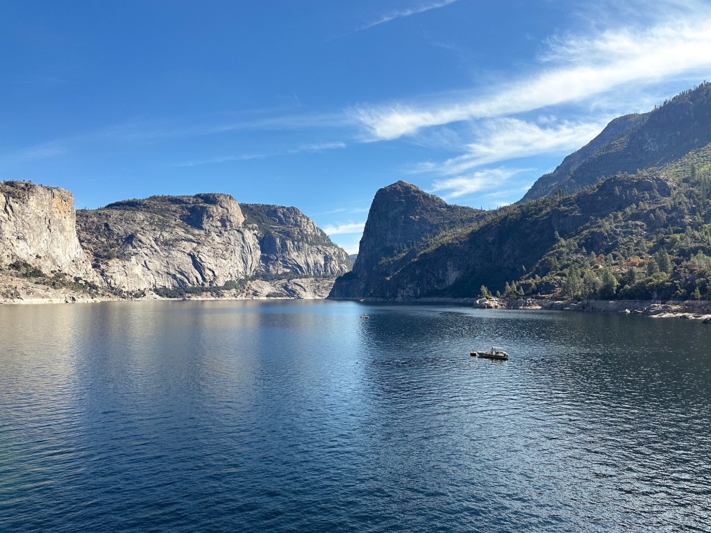
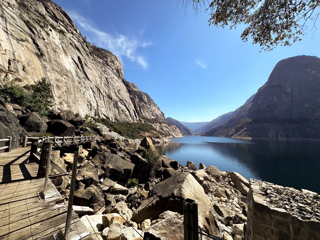
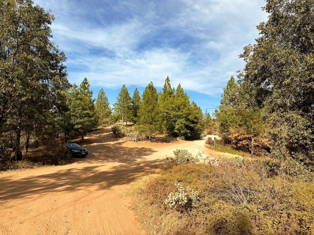
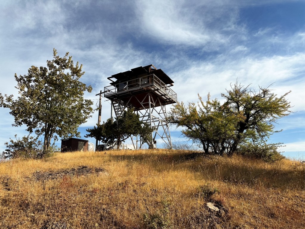
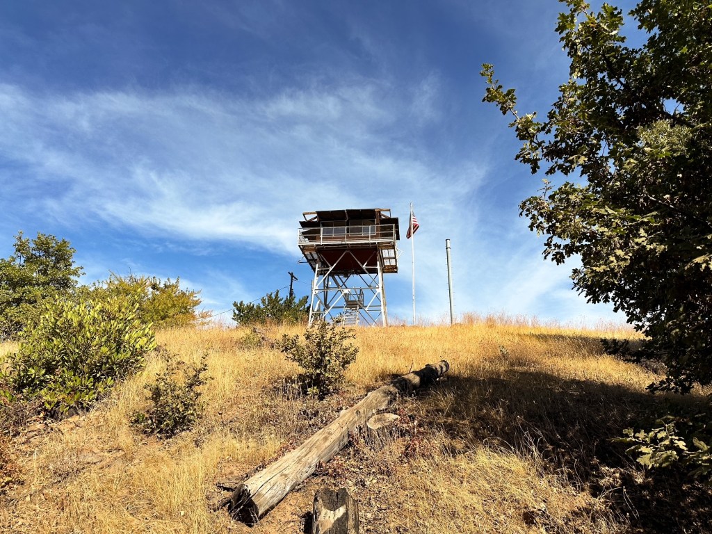
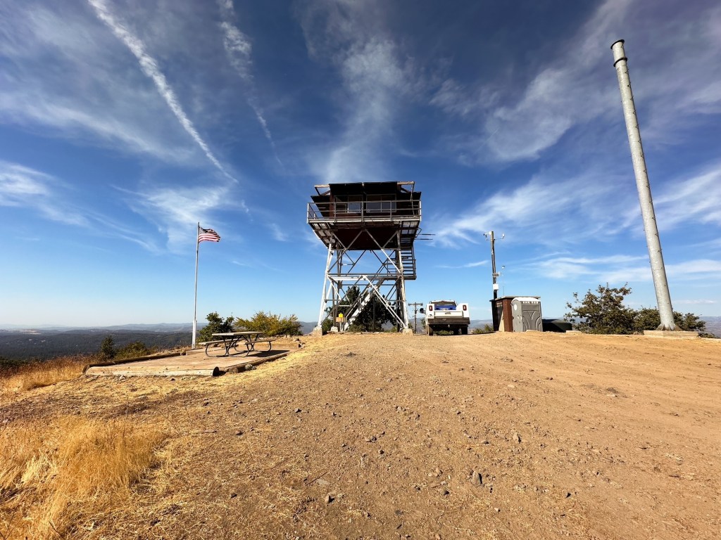
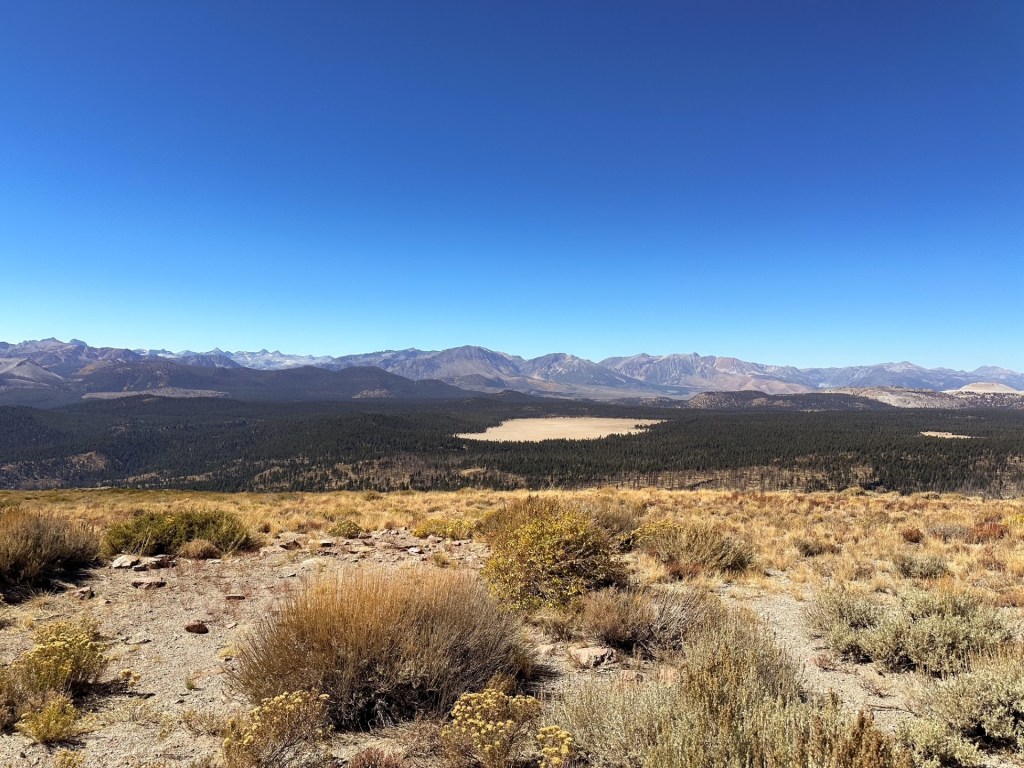
I had planned our trip to have a day to explore most sections of the national park to see as much as possible in our limited time. Our third day was designated to exploring the Hetch Hetchy reservoir. If we had time we would make a side trip to Smith Peak lookout on our drive back to camp. This area of the park is located in the north western corner. It required leaving and re-entering the park, so it set us up well to visiting a fire lookout just outside the boundaries. The access to the Hetch Hetchy area is off a steep and narrow road with limited trail options. It seemed like most trails were utilized for access to longer backpacking routes. I settled on sticking to the classic hike along the reservoir to Tueeulala and Wapama falls. The biggest downside to visiting Yosemite this late in the season was most of these waterfalls were dry. The trail follows an old railroad cut that is relatively flat, but offers little reprieve from the sun. Despite Strava only calculating this hike at 4.80 miles with 585′ of elevation gain the heat made it challenging. Our energy was tapped by the time we made it back to the car.
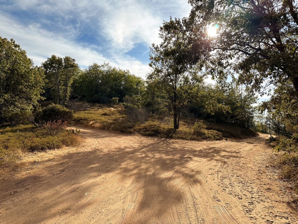
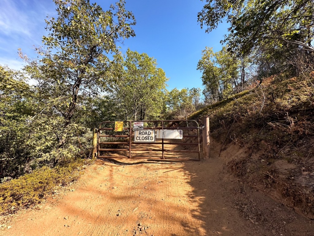
I wanted to head straight back to camp afterwards, but we decided to continue to the Groveland Ranger station to buy a map of the area. Garnet was interested in looking at the routes to other fire lookouts, but they were completely out of the map we wanted. After some debate, we decided to continue on to Smith Peak. The access road was located just behind the ranger station and we were already there. We followed the paved road to the Pines Campground and turned into it. The road turned to dirt and continues beyond the campground. We debated parking here and walking the road since it was close enough, but ended up continuing on for the same reason. If we found the road inaccessible we could always turn around. There were some minor hazards to avoid if you are driving a low clearance vehicle but it is passable. After driving for a mile and a half we reached a 5-way intersection. We parked in a pull out here since we figured the remaining distance to the summit was behind a gate. It was not immediately clear which road led to the summit from here. We took a guess and headed left based on which road looked the most used and angled towards the summit. It was confirmed we made the right selection when we reached the gate farther down the road. From where we parked to the summit was less than half of a mile. Strava calculated this at 0.95 RT with 174′ of elevation gain. If we had decided to park at the campground, the hike would have been closer to 4 miles RT with 680′ of gain.
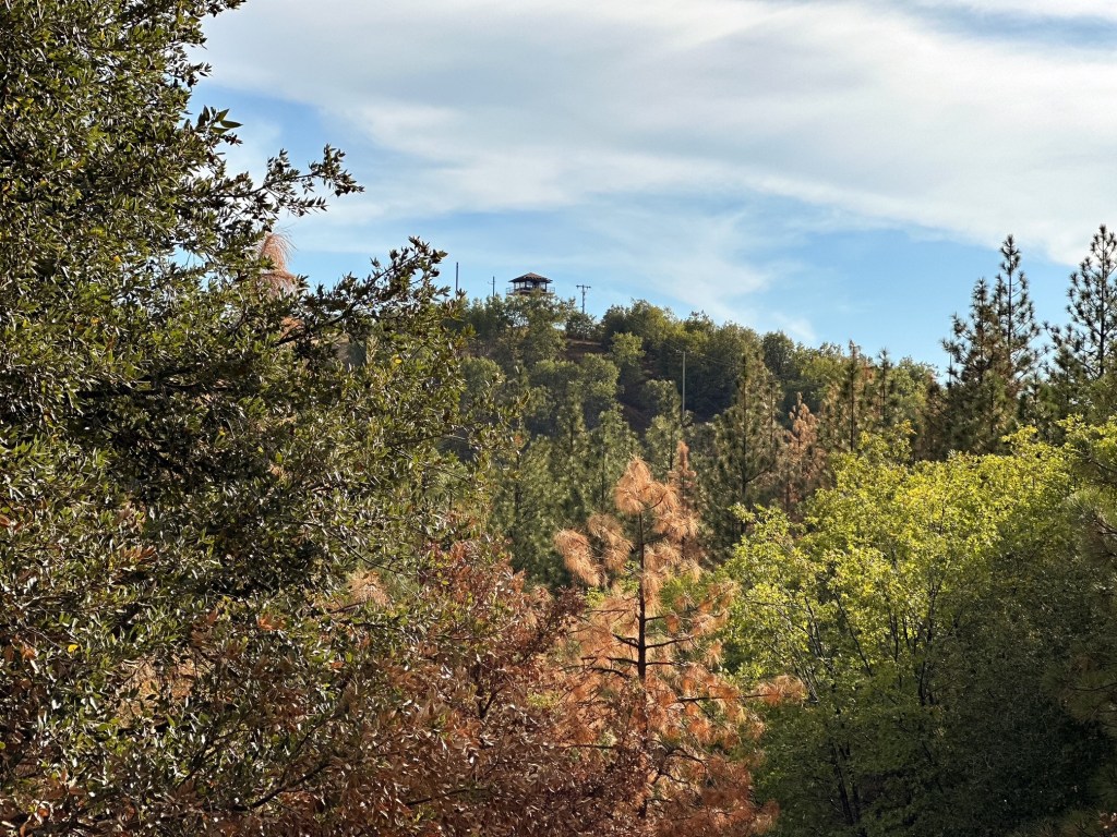
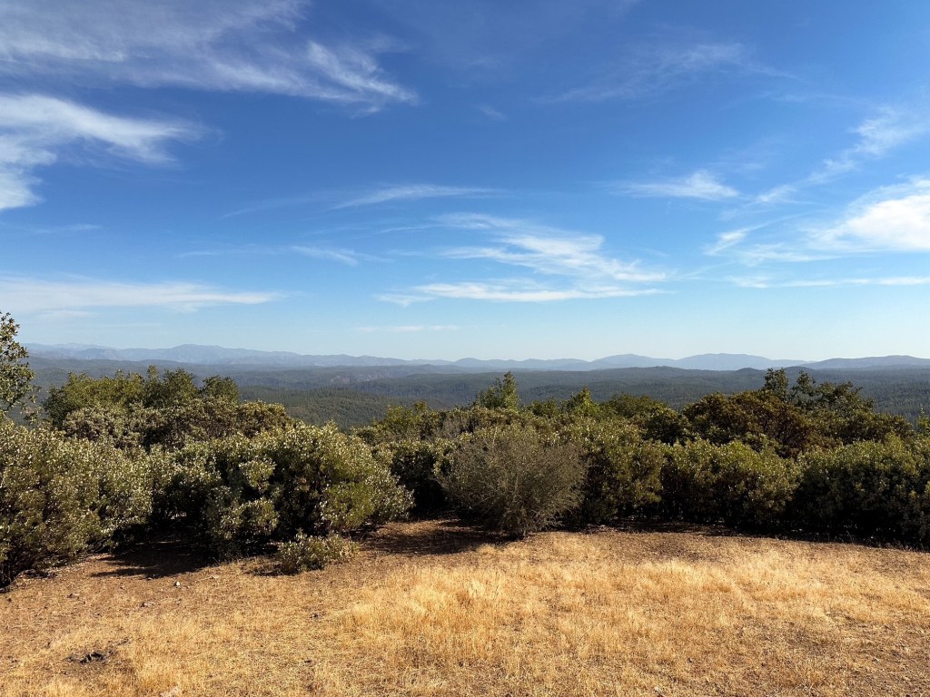
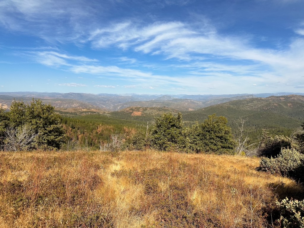
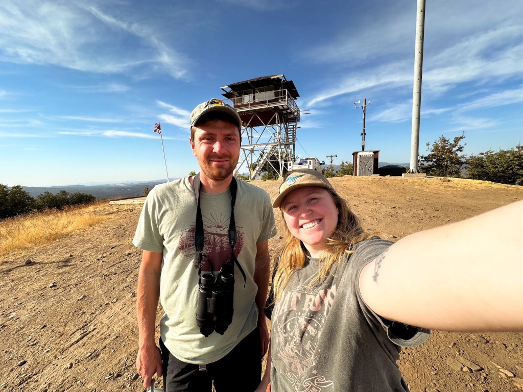
Our biggest surprise after we reached the summit was meeting the lookout attendant onsite. We figured even if it was still staffed the person would have already been done for the season or have had left for the evening. He invited us up to chat, but not all the way on the catwalk. The view from the ground was about the same as it was from the stairs. Unfortunately neither of us can recall his name, but we chatted with him for awhile about lookouts and the surrounding area before heading back to camp for the night.
History.
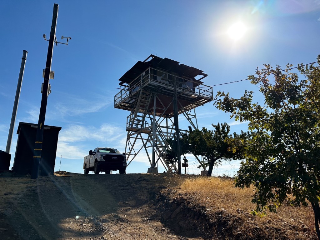
In 1931, Smith Peak was selected as an administrative site to build a lookout tower. A wooden 2-story tower was built shortly after it’s selection. Old archive pictures show this structure was reminiscent of a national park style cab with slight variations. It is mentioned that the site has been utilized for fire detection as early as 1910 given it’s proximity to the ranger station. The wooden structure was replaced in 1952 by a metal lookout tower and garage. This burned down in 1987 during the Stanislaus Complex fire and was replaced by the existing structure in 1988. This site continues to be actively staffed every season and is one of only two remaining staffed in the Groveland Ranger District.
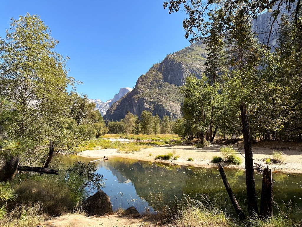
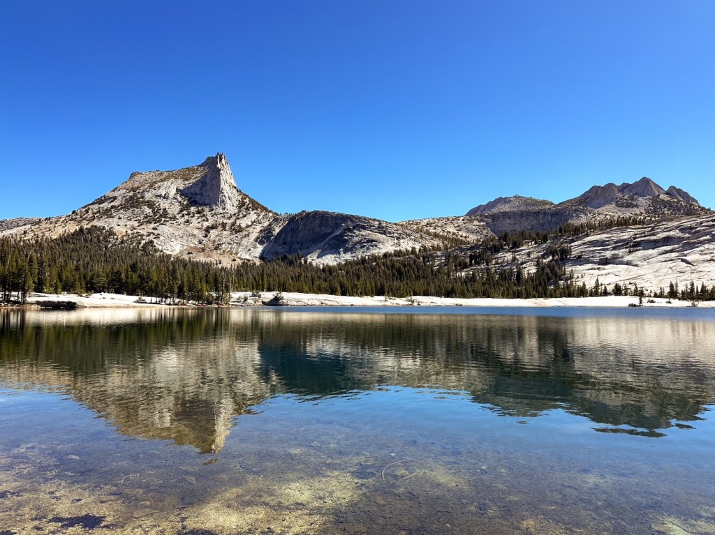
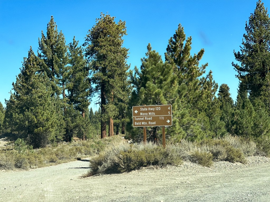
I felt we were able to get a good overview of Yosemite National Park by spreading out our hikes in each area. We spent our fifth day in the main valley collecting souvenirs and our sixth in Tuolumne Meadows hiking to Cathedral Lakes. We really only missed the most southern section with the Mariposa Grove. Though I hope the next time we get to visit the park will be via backpacking in their expansive backcountry. After our long travel day to the park at the start of our trip, I was happy we opted to take two nights to head back to Oregon. This broke up the drive and allotted us to make some exploratory stops along the way. I thought about trying to squeeze another short hike in before exiting Yosemite, but we both agreed we needed to make progress on our drive time. Especially since we opted to take the scenic route back via HWY-395.
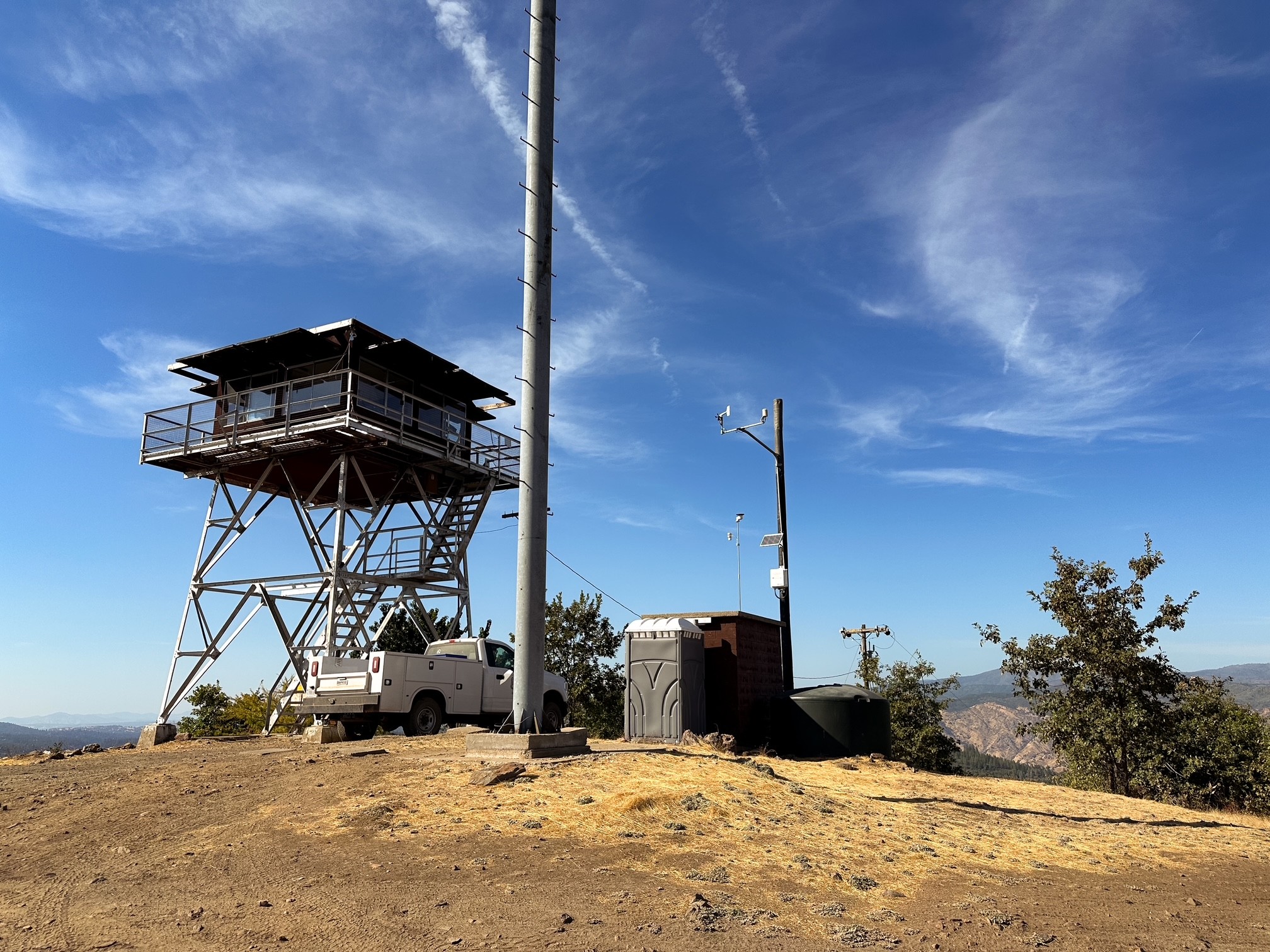
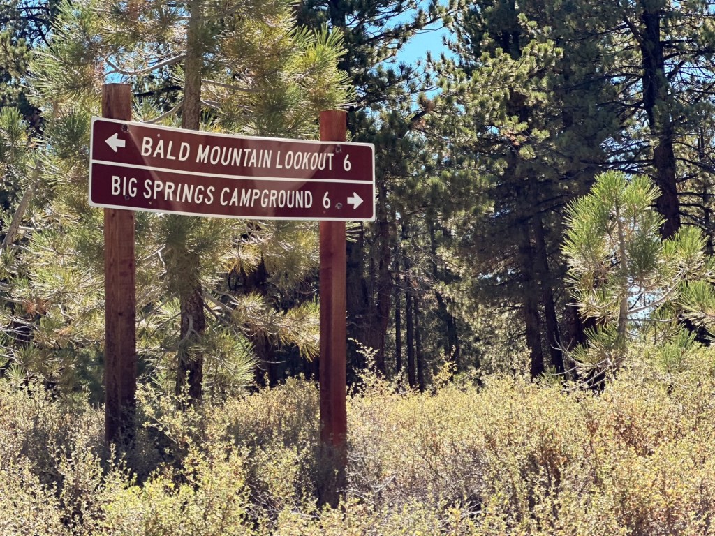
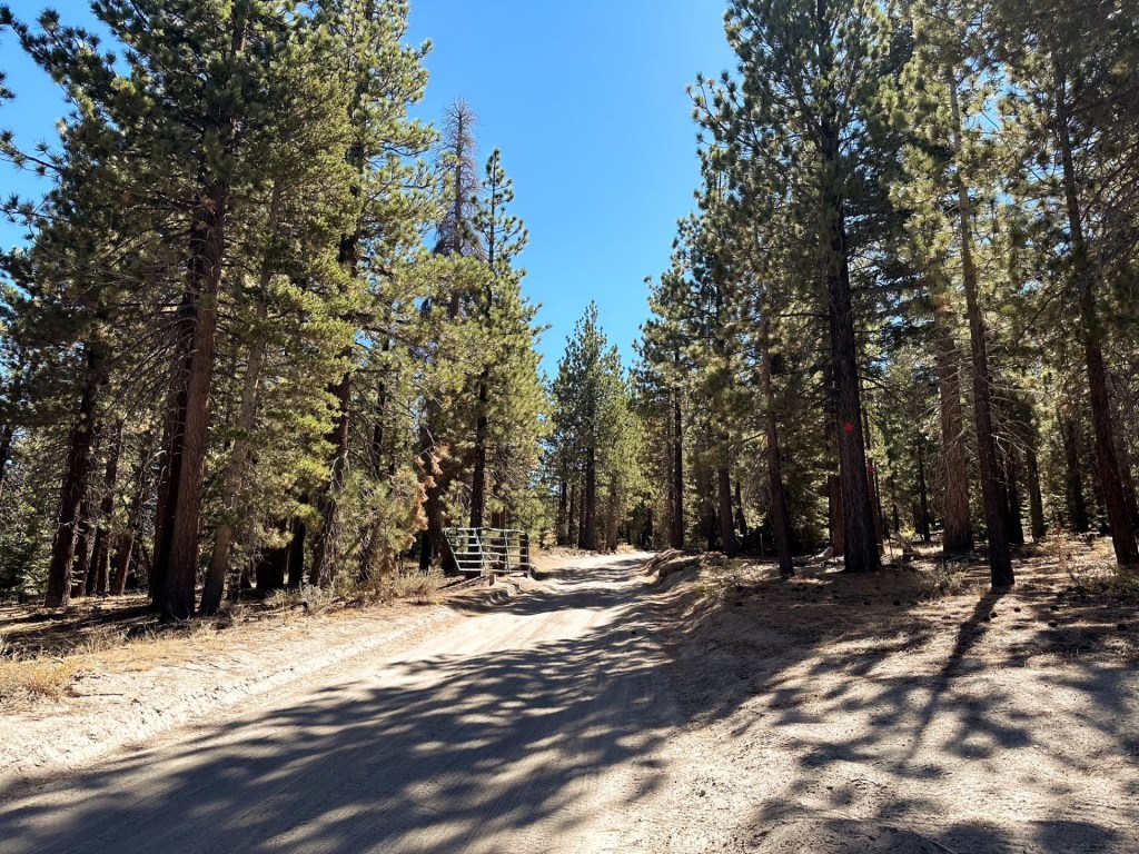
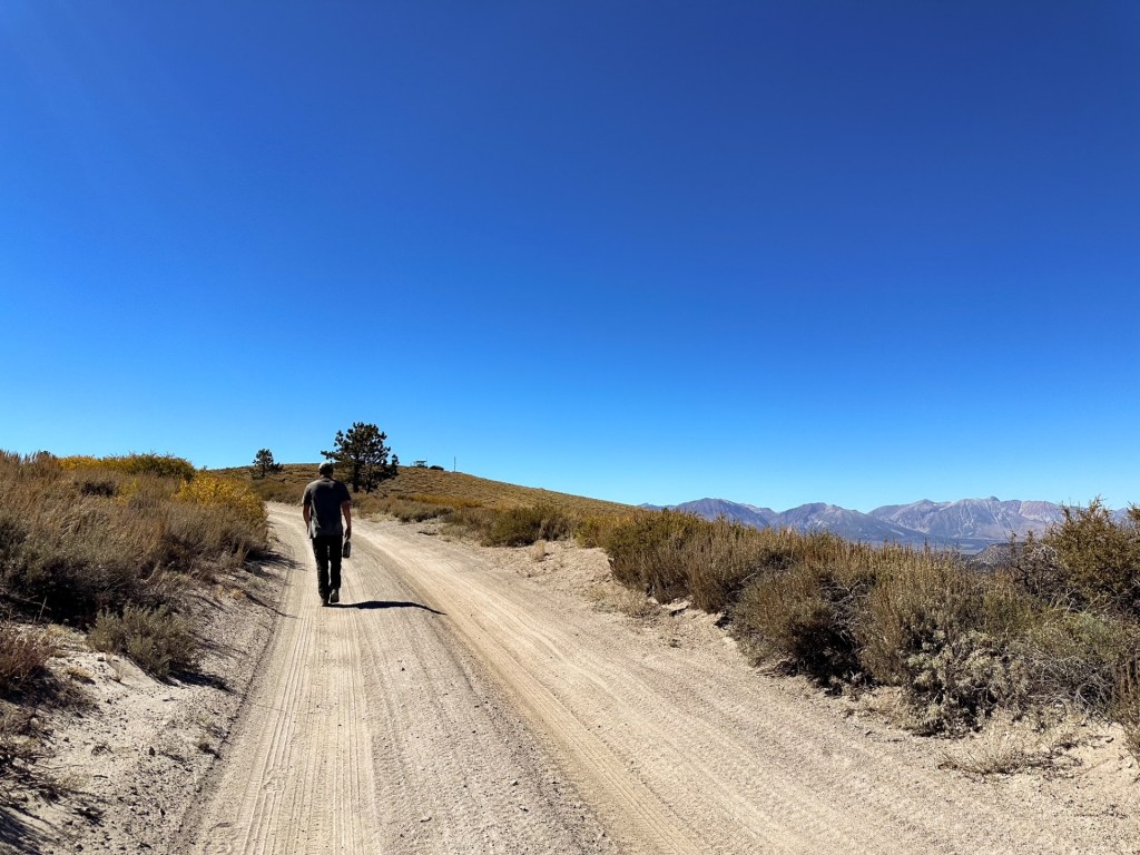
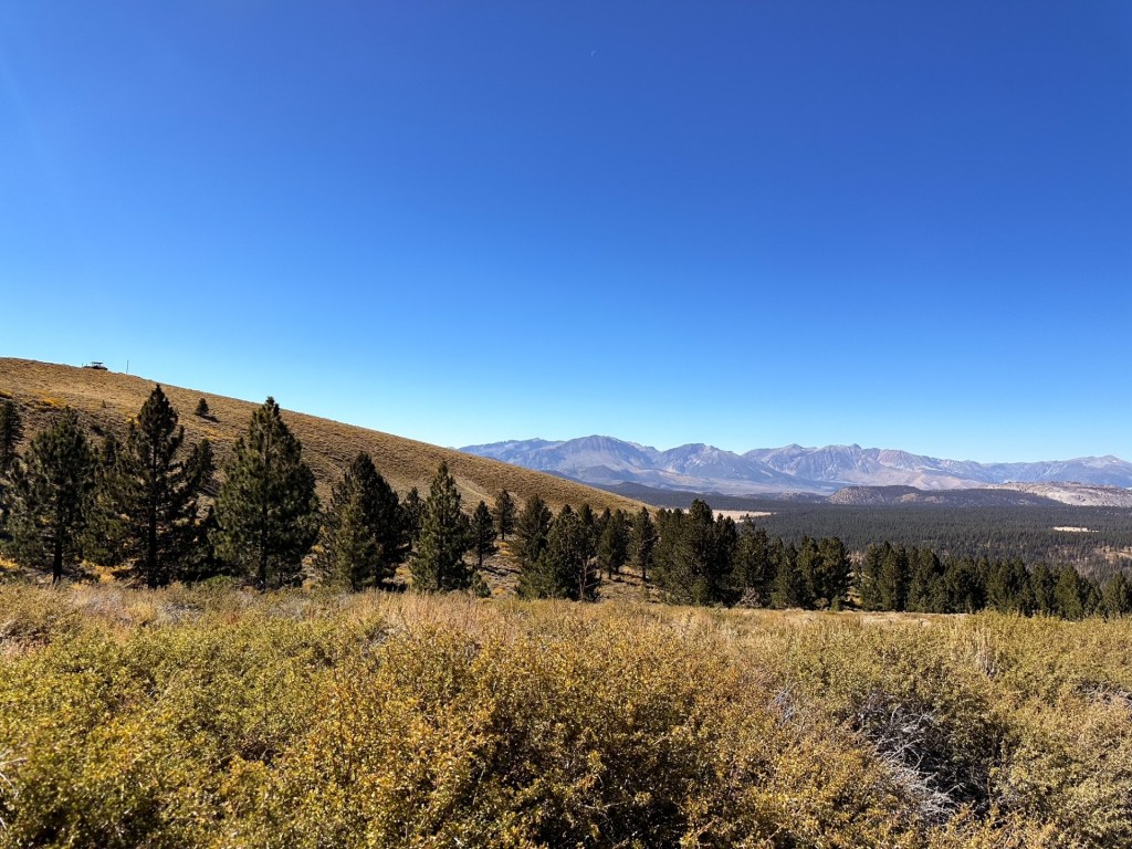
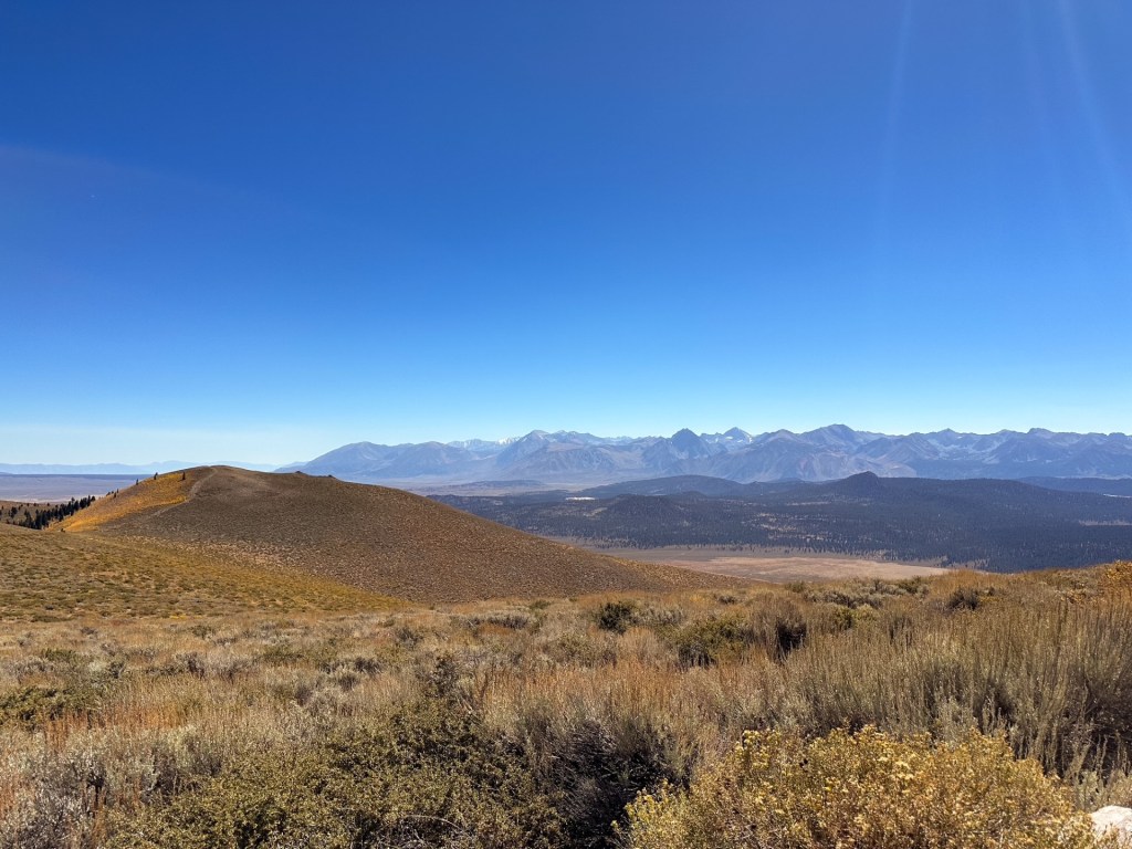
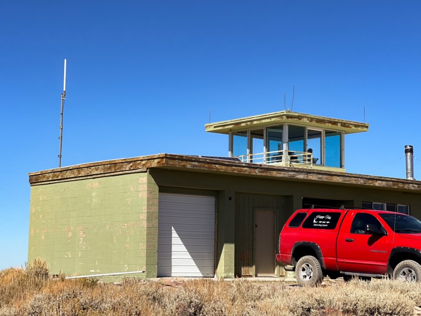
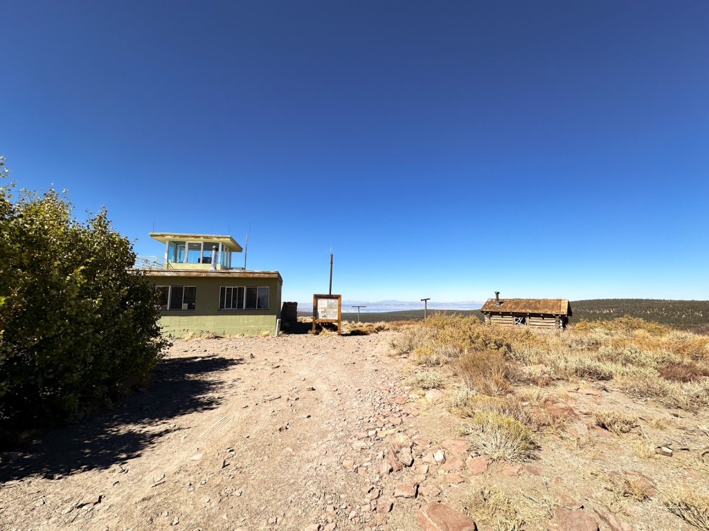
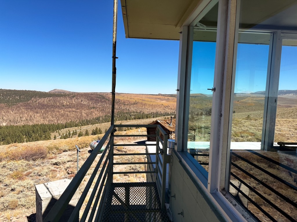
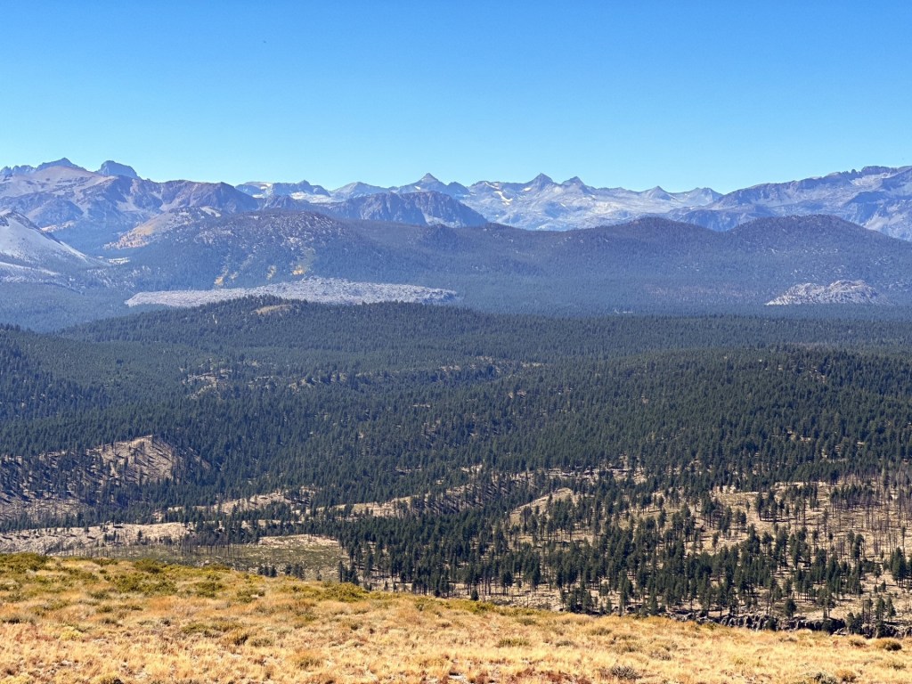
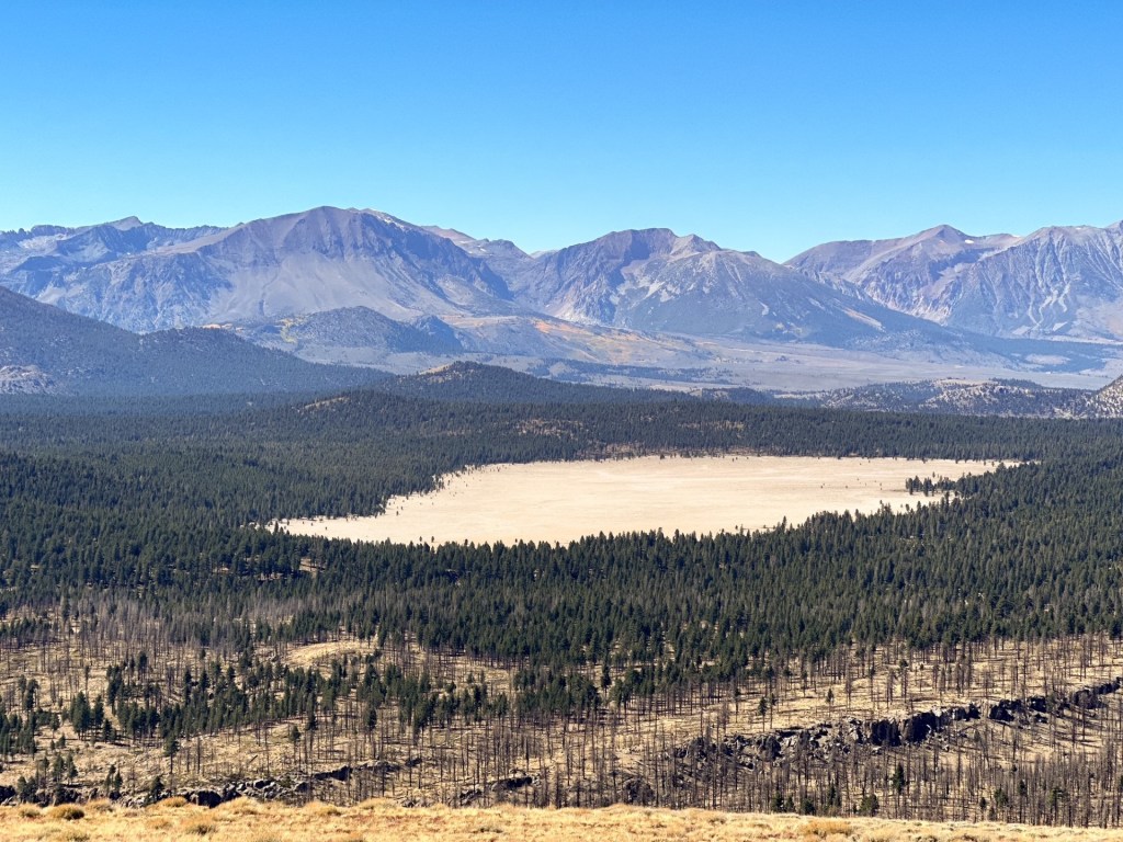
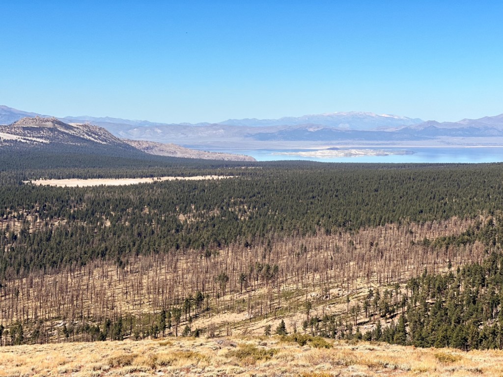
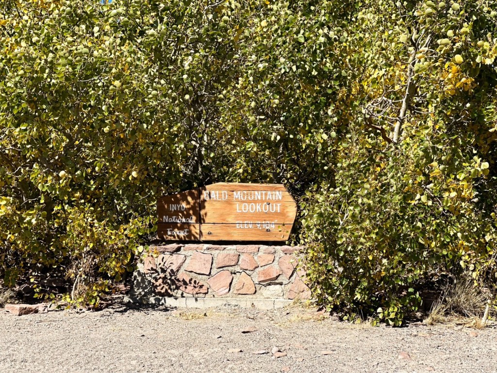
Bald Mountain lookout is just south of where HWY-120 meets HWY-395, or where the eastern exit to Yosemite National Park spits you out. This is a unique stand alone mountain that rises up out of the valley to offer 365 views of the surrounding area. Though we passed on any additional hikes, we figured it made sense to make a small detour here before heading north. Especially since we do not make it down to this area often and this fire lookout stands out by itself from others. Heading south on HWY-395, we kept an eye out for the left turn since we would have to cross traffic and were not sure if it’d be obvious. The road was labeled as 1S05 on the map, but was Bald Mountain Road from the highway and on GPS. There was thankfully a turn lane to avoid blocking any traffic and allowed us to wait for a safe crossing. From there the road turns to a mix of gravel and sand – I was a bit worried about how our car would handle the sand. We followed the main use road and any signs that pointed us towards Bald Mountain. It felt pretty straight forward to us but there are junctions were one could get turned around if not careful.
The scene of the crime
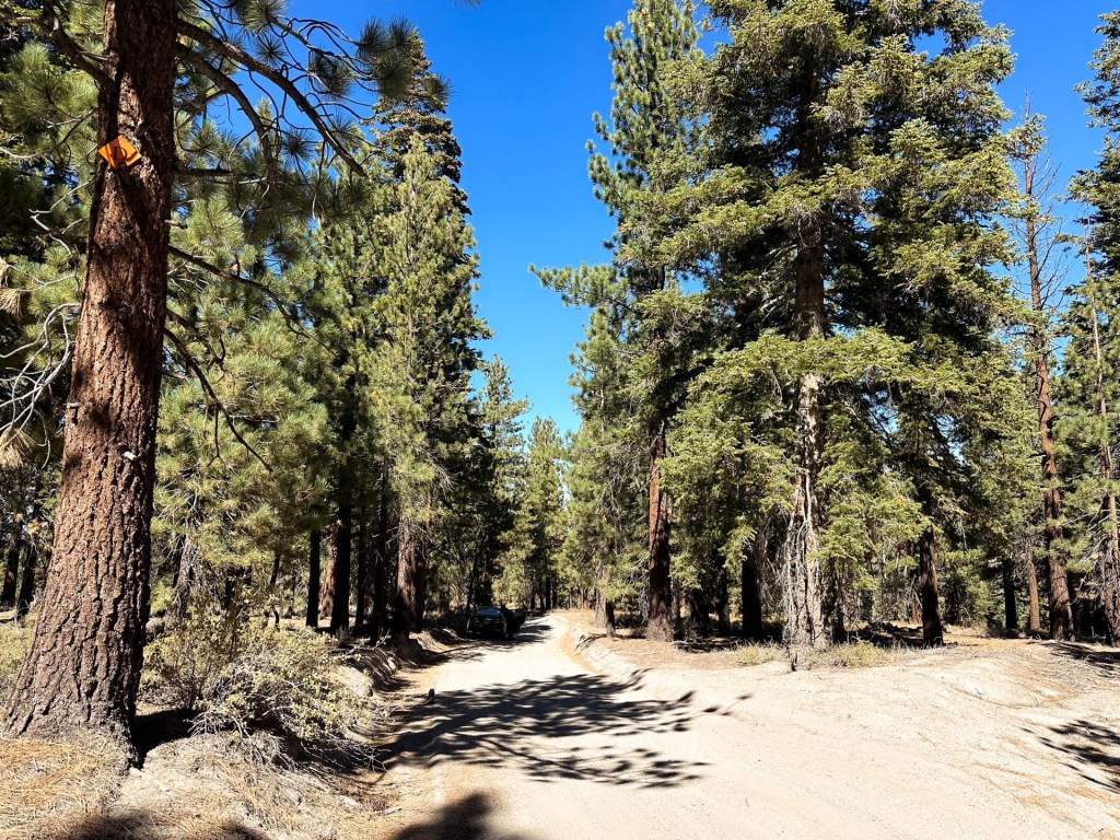
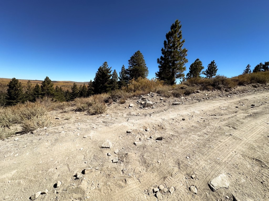
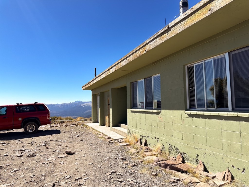
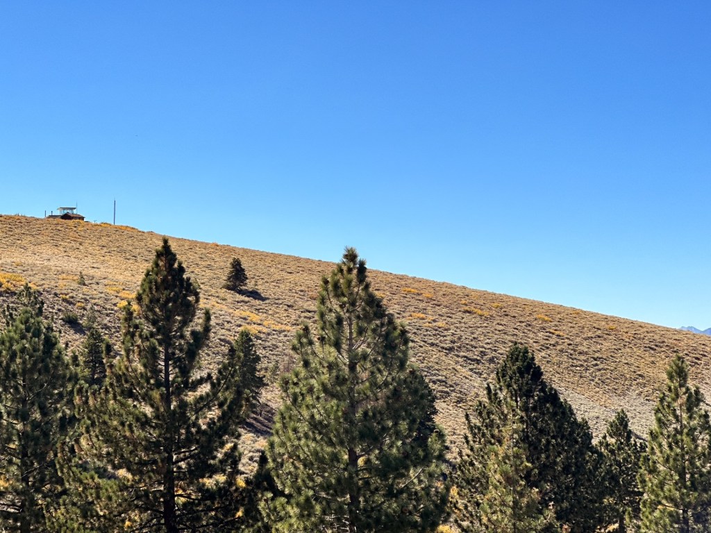
The road was passible to our car up until we reached the gate. There were some squirrely sections in the sand prior, but if you keep your momentum and don’t get too close to the soft shoulders you will be fine. I’d recommend parking and walking from the gate if you are in a low clearance vehicle. Garnet was driving this time and wanted to see if we could drive the remaining distance. This would end up being one of our bigger mistakes visiting a fire lookout. The road started out fine, but it is rocky and narrow. It does not offer room to pass if you meet another vehicle except in an area right before the summit. Unfortunately before we reached that larger pull out the road got worse and I wanted to bail out. We probably would have been fine if we had committed to making it at this point, but instead we tried to turn around to avoid backing all the way down. This area was rockier than the rest of our drive, but it was still a mix of soft sand. Given those conditions, I’m sure it’s no surprise to read that we got ourselves stuck. Not majorly but enough to be concerned about how we were going to get ourselves out. Our wheels were having a hard time finding purchase and we tried adding rocks under the tires to help build traction without digging ourselves deeper. There was potential for high-lining our car or at least cause significant damage to the undercarriage. Eventually someone was driving down from visiting the summit and they stopped to help. They were able to assist Garnet in giving us a good push from the back, while directing us in the front areas we couldn’t see by ourselves. We were extremely thankful and embarrassed at the same time. Once we were back on the road we had to back down all the way to the gate to let them pass. We parked in a pull out just before the gate and walked the rest of the road, as we should have from the start.
It was only a 0.8 mile walk from the gate to the summit with 382′ of elevation gain. Strava calculated the total round trip distance at 1.77 miles, but the additional was due to walking around the lookout. We were greeted by a friendly attendant named Karen that invited us up to take a look around. She told us she was a volunteer from the San Bernadino area and that this lookout was staffed on a rotating basis of volunteers. It was cool to see a new program in action from the efforts of the FFLA to help keep this lookout in service. Karen used to work on Keller Peak LO and was the first woman to repel down El Capitan (so cool!). She told us how we just missed some other visitors that were worried about meeting cars on the road during their drive down and that she had seen a car heading up at the same time but was unsure what happened. We were too embarrassed to tell her that was us, or that we got stuck, or that they had to help us. I felt even worse to hear that we became their worst fear. There was not much we could do about it now except look back and laugh.
History.
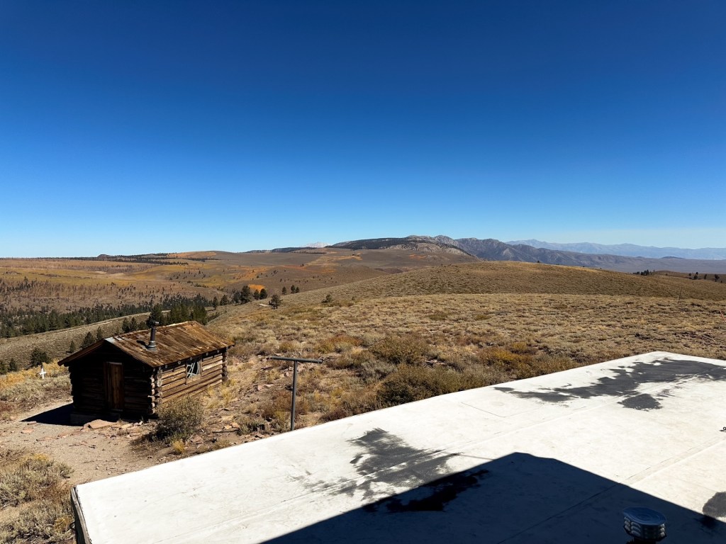
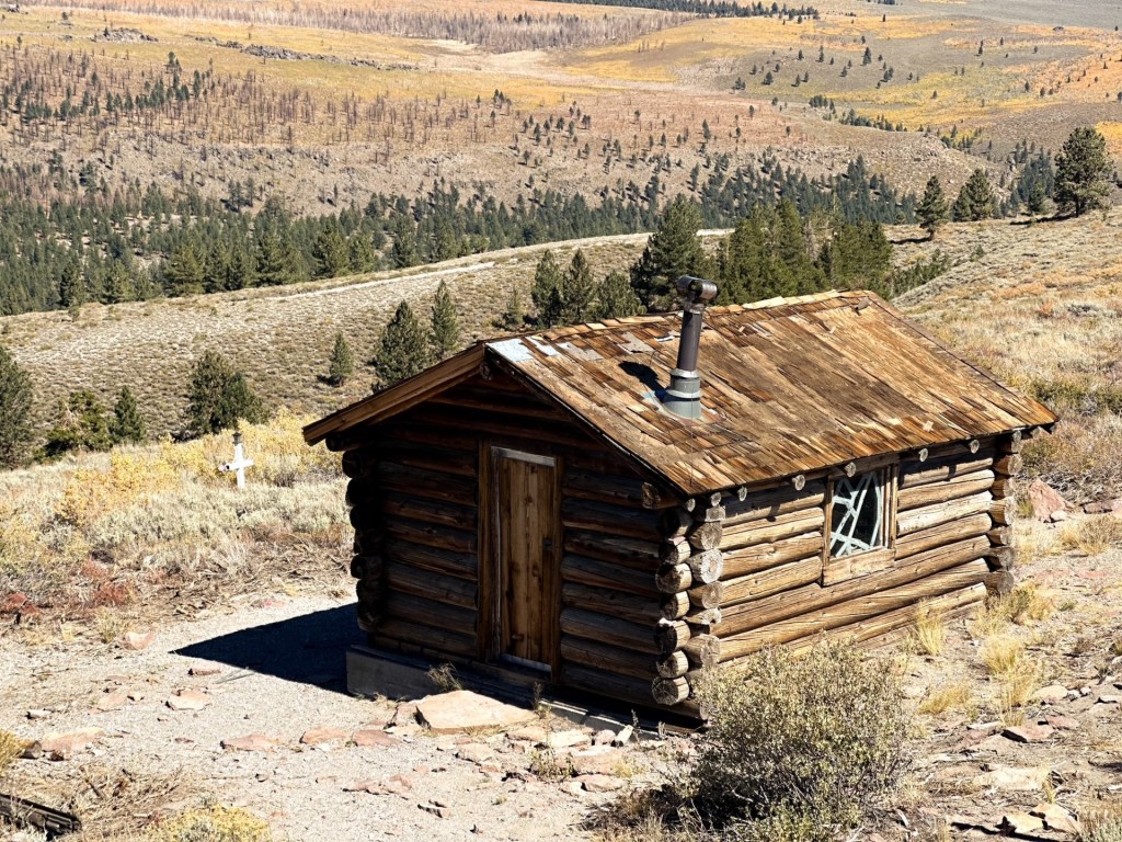
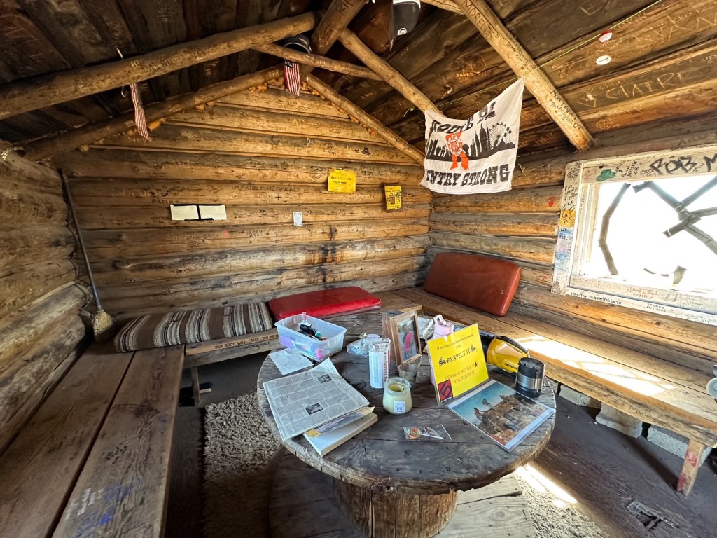
Bald Mountain is one of only two fire lookouts still standing in the south-eastern Sierra and the only one left in operation on the Inyo National Forest. The original structure was built in 1943 by the Civilian Public Service (an agency that followed the CCC and was staffed by conscientious objectors of WWII). There is still a log cabin onsite that is believed to be part of the original buildings from this era and is still used as a warming hut for skiers in the winter. In 1963, the current 16′ x 40′ concrete block lookout with 10′ x 10′ steel cab was built. This unique structure includes living quarters, two garages, and a storage room. It was actively staffed by the Forest Service into the 1980s. It was not until recently, in 2024, that it was brought back into service via a volunteer partnership between the FFLA and the Mono Lake Ranger District.


 (
(